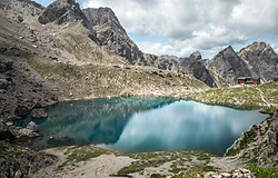
Natural Resources
Comprehensive solutions to optimal usage of Natural Resources and model to reduce the severity, in the event of disaster

Dexsini offers technical and consulting solutions to government, non- government organization and private entities in agriculture and insurance. With multi- disciplinary team, we provide solutions to food security, sustainable livelihood development and weather based agricutural forming.
With combined approach of using geospatial, statistical and analysis methods coupled with required field surveys to deliver solutions for natural resources and its sustainable development model with optimal time and budget
Solutions

Agro- Management and Suitability Models
Dexsini builds model for agro - management through satellite imagery coupled with other spatial data and agricultural attributes such as area, cropping pattern and yield. This model can be regularly updated and monitored and stored in a spatial database for further studies and giving justification of result from the model
-
Suitability assessment studies
-
Crop Monitoring and Solutions
-
Climate Map - Precipitation, Temperature
-
Crop Mapping
-
Irrigation Mapping
-
Yield Estimation
-
Location Intelligence - Solar Panel

Water Sources
We provide support for water resource projects which include comprehensive watershed and flood protection planning, design and analysis including complex hydrologic modelling; with continued research in the area of GIS use of water resources we offer solutions with a practical understanding. Dexsini specialized in integrating custom solutions for water resource data model with routine procedures in database creation & maintenance, spatial analysis and cartographic products

-
Watershed Delineation
-
Storm Water Channeling
-
Ground Water Monitoring
-
Rainwater Harvesting System
-
Decision Support System - Hydrologic Modelling
-
Mitigation